
Kane County Transit Study
Kane County, Illinois
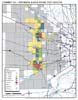
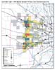
Kane County is located on the western fringe of the Chicago Metropolitan Area. Its nearly 5,000 residents are unevenly distributed over an area of 520 square miles. Settlement patterns range from small to mid-sized older cities in the eastern part of the county, to sparsely settled largely agricultural areas in the west. The purpose of the study was to effectuate a land use policy that would strengthen demand for public transit and reduce dependence on the automobile. In support of the effort, Okrent Associates created a geographic information system (GIS), which facilitated an automated analysis of demographic patterns and transportation networks.
click image to enlarge